















A two-way cycle route, new pavements, changes to crossings and additional loading and disabled parking bays are proposed for the A259 coast road between Hove and central Brighton. Residents have until 25 October to comment.
Plans to change the layout of part of Brighton & Hove’s seafront have opened for consultation, with proposals covering the A259 between Fourth Avenue and West Street.
Brighton & Hove City Council is seeking views on the next two sections of its active travel scheme, including a redesign of existing cycle lanes and changes intended to improve walking and wheeling routes.
The same A259 corridor is also subject to a separate renewal of Brighton’s seafront arches.
The six-week consultation was announced on 14 September 2026. The council’s Your Voice project page lists the survey as closing on Sunday 25 October.
A259 seafront proposals at a glance
| Scheme | A259 Hove to Brighton Active Travel Scheme |
|---|---|
| Overall section | Fourth Avenue, Hove, to West Street, Brighton |
| Phase 3 | Fourth Avenue to the Peace Statue |
| Phase 4 | Peace Statue to West Street |
| Main proposals | A separated two-way cycle lane, new pavements, revised crossings and junctions, and new loading and disabled parking bays |
| Consultation deadline | Sunday 25 October 2026 |
What would change on the seafront?
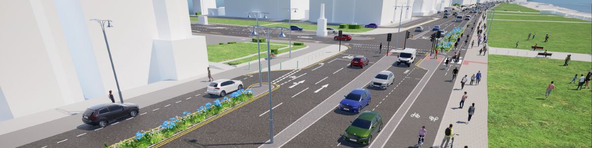
The proposals would replace the existing cycle arrangement with one two-way lane separated from motor traffic and pedestrians.
In its announcement of the consultation, the council says this would remove the westbound cycle lane currently separated from traffic by plastic wands.
The council describes the replacement as making better use of the available space and meeting modern design standards.
The plans also cover new pavements and changes to the alignment of crossings and junctions. New loading bays and disabled parking bays form part of the proposals, making this a consultation about more than the route used by cyclists.
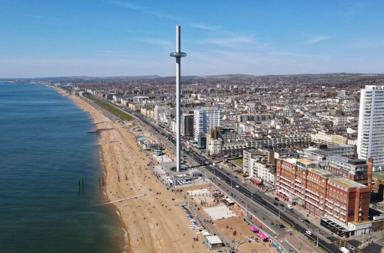
The area includes Hove Lawns, the Bandstand, the i360, the Brighton Centre and Shelter Hall.
What should residents look for in the plans?
For someone commenting on the scheme, the useful detail is how the layout would work at the places they actually use.
A pedestrian may want to examine where they would cross the cycle route to reach the seafront, which of course you do anyway in the existing layout.
Those are different questions from whether a person supports cycling in general. Comments identifying a particular junction, crossing or access problem can explain what a design would mean in everyday use.
Someone using a wheelchair or mobility aid may need to consider the route between a disabled parking bay, crossing and destination. Businesses may want to look closely at loading arrangements. These are the two biggest contention points to the proposals with less parking spaces.
The council has also published a computer-generated flythrough of the proposed scheme. It provides an illustration of the intended layout, rather than footage of completed changes.
Author’s thoughts as a resident and user
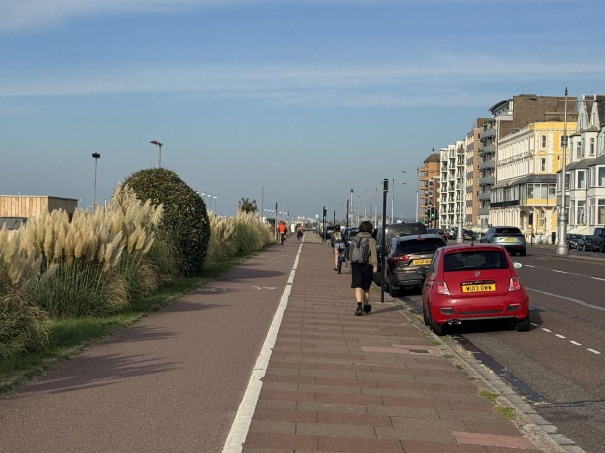
As a local I welcome clearer markings so it’s clear to pedestrians they are crossing a cycle lane. Also from the illustration it appears the the bike lane is being moved to the road side of the pavement, rather than the grass side. This to me is a lot more logical, and will help to prevent accidents with young children naturally running towards the open space across the same colour flooring as a playground. I’m sure cyclists would also appreciate less people walking in front of them.
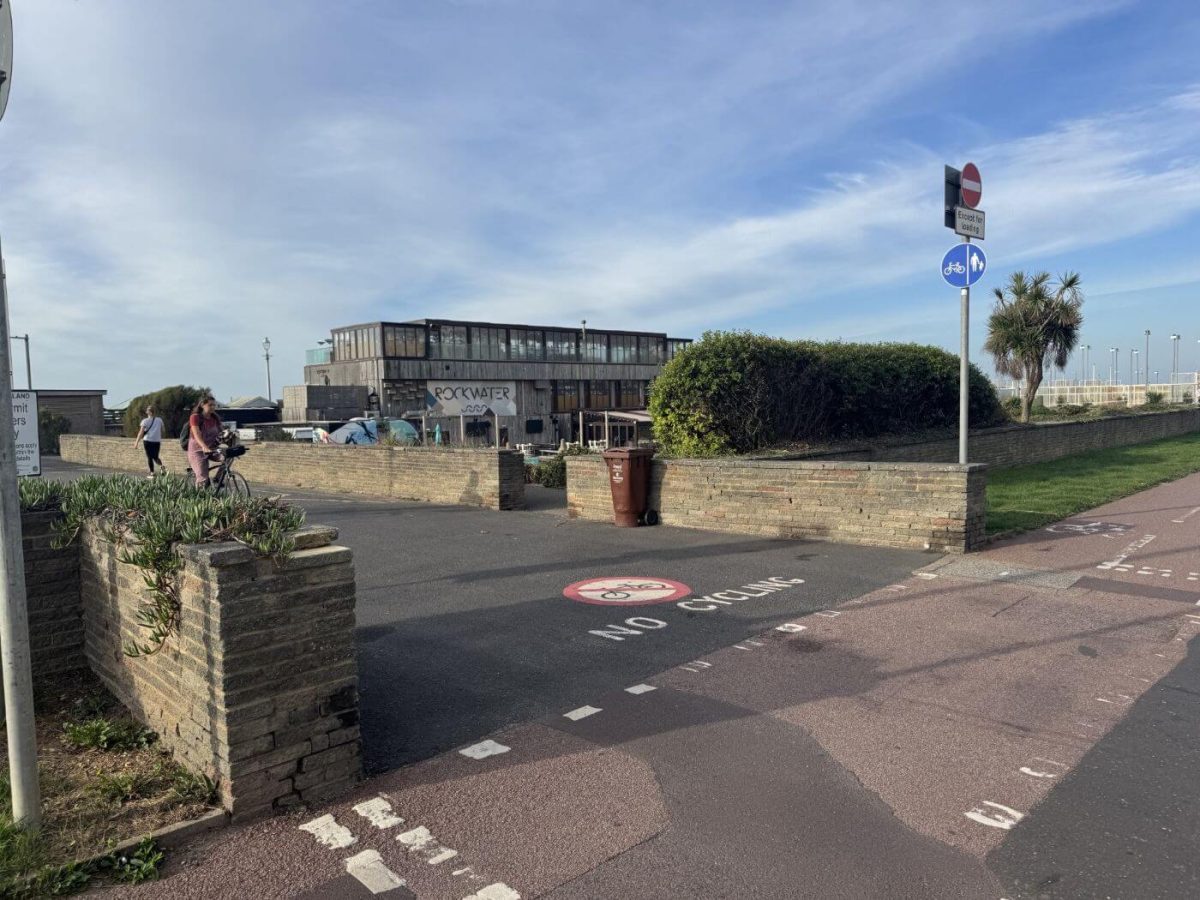
I’m not anti-cyclist in the slightest, but you can see from the two pictures used (taken in the few minutes I was there) that bikes either don’t see the signage too or feel it doesn’t apply to them. With children or adult visitors from out of town I have to always point out the bike lanes and occasionally physically stop them walking in them, which suggests it’s not clear enough. And of course bikes move fast and silently, and I often see people walking wearing big headphones so can’t hear the bells ringing.
How does this relate to the Hove-to-Portslade scheme?
The latest consultation concerns phases 3 and 4 of the wider A259 programme.
The earlier Hove-to-Portslade proposals cover the route west of Fourth Avenue including Hove Beach Park. Phase 1 runs to Wharf Road, while phase 2 continues towards the city’s western boundary.
Those western sections were consulted on in 2025. The new exercise concerns the stretch heading in the opposite direction, towards central Brighton.
Which consultation?
This one is about Fourth Avenue to West Street
The A259 programme has several sections. When looking at drawings or responding, check that you are viewing the Hove-to-Brighton proposals for phases 3 and 4, rather than the earlier consultation on the route west towards Portslade.
What funding has been announced?
The council’s project information says it has secured £780,000 from Active Travel England to support improvements along this route for walking, wheeling and cycling.
The consultation is intended to help shape the final design. An announced funding allocation should not be confused with confirmation that every layout detail has been settled or that construction on these sections has begun.
How to have your say
The online survey is available through the council’s Your Voice platform. The council says it takes around 10 to 15 minutes and allows people to answer questions about either or both phases.
Respondents are asked to refer to the proposed plans while completing the questions.
There are also two advertised opportunities to discuss the proposals in person: a drop-in at Hove Town Hall reception on Thursday 24 September and a seafront session near the Peace Statue and café on Saturday 17 October. Check the individual event listings for times before travelling.
The deadline for survey responses is 25 October 2026. The published project timeline then provides for analysis of the responses during late October and November.
You May Also Be Interested In