













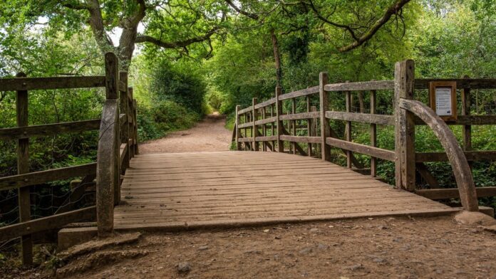
You hear the stream before you see it. The walk to Poohsticks Bridge drops through woodland near Chuck Hatch to a small crossing where the game from A. A. Milne’s stories still makes sense. It’s a short outing with time built in for leaning on the rail and watching the water.
Distance and walking time
| Option | Distance | Walking time |
|---|---|---|
| Pooh car park to the bridge and back | About 1 mile / 1.5 km return | 30–45 minutes walking, plus time at the bridge |
Times are planning estimates. Short distances are rounded from the mapped walking line. Allow extra time for stops, conditions and your pace. Measured bridge walk.
From Pooh car park to the bridge
Start at Pooh car park on Chuck Hatch Lane, near Hartfield. Take the bridleway from the car park downhill through the woods to the bridge, then retrace your steps uphill. Allow up to an hour for a family outing with a stop at the bridge. The Conservators place the bridge just outside Ashdown Forest itself, so search for the Pooh car park rather than navigating to the Forest Centre. Directions from the Conservators.
The track is unsealed and can turn muddy. A short distance here can still be hard work with small wheels, particularly on the return climb. Bring sticks from the path if you find any and leave the trees and plants alone. Give other walkers room to cross the bridge.
How to get there
By car, use Chuck Hatch Lane and look for the dedicated Pooh car park. It is managed separately from the Conservators’ forest car parks, so check its signs for any charges. The Metrobus 291 serves Hartfield. It’s useful for Pooh Corner in the village, but getting from the village to the bridge adds a walk. Check the onward route and return bus before you set out.
Make a longer day of it
For open views and heathland, plan a separate stop around Gill’s Lap. The Forest’s walking trails are a better starting point than trying to improvise a circular from the bridge. Pooh Corner is back in Hartfield if you want a village stop after the walk.
Step-by-step directions
- From the car park on Chuck Hatch Lane, take the signed bridleway into the woods. The outward leg is downhill.
- Stay on the main bridleway through the trees. Follow the signs for the bridge at any junction and leave the smaller woodland tracks for another day.
- At the stream, stop on the bridge if there’s space. The crossing is the turnaround point for this route.
- Return up the same bridleway to the car park. Allow more time for the climb than for the outward leg.
Parking, toilets and accessibility
Parking
Use Pooh car park on Chuck Hatch Lane, near Hartfield (grid reference TQ472332). It is managed separately from the main Ashdown Forest car parks, so check the signs on arrival. If it’s full, avoid blocking the lane or passing places.
Toilets
Plan a toilet stop before the bridge walk. The car park and bridge are a woodland stop with no confirmed public toilets. Pooh Corner in Hartfield publishes visitor information, and the Ashdown Forest Centre has a Changing Places facility. The Centre is a separate stop by road. Pooh Corner visitor information · Ashdown Forest facilities.
Access and surfaces
The bridleway is unsealed and slopes down to the bridge. Mud, loose surface and the uphill return can make it hard with a wheelchair or small-wheeled buggy. The Conservators suggest King’s Standing and Broadstone for disabled parking with flatter ground nearby if you want a different forest outing.
Route map
Pooh car park to the bridge
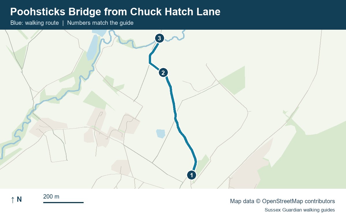
- Pooh car park on Chuck Hatch Lane
- Woodland bridleway through Posingford Wood
- Poohsticks Bridge, the turnaround
Ashdown Forest map · Map of the walk to Poohsticks Bridge
For more coastal and countryside routes, see our guide to walks in Sussex.
You May Also Be Interested In