













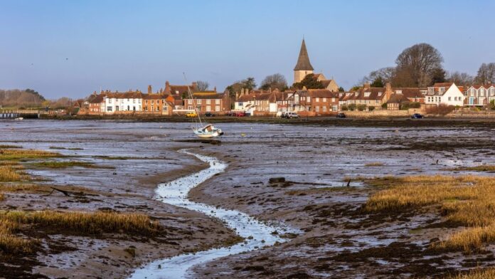
At Bosham, the tide can change the view entirely. Boats sit on the mud at low water and float in front of the village a few hours later. The church spire is the landmark to aim for whether you’re strolling down from the village car park or walking in from Fishbourne.
Distance and walking time
| Option | Distance | Walking time |
|---|---|---|
| Bosham village, quay and creek loop | About 1.25 miles / 2 km | 30–45 minutes, plus stops |
| Fishbourne Mill Pond to Bosham | About 2.5–3 miles / 4–5 km one way | 60–90 minutes, excluding onward travel |
Times are planning estimates. Allow extra time for stops, conditions and your pace. Bosham easier-access map · Fishbourne to Bosham map. The longer distance is a planning estimate for the first part of the published stage..
The short Bosham Quay walk
Start at the village car park and walk towards Holy Trinity church and the quay. Spend as much or as little time at the waterfront as you like, then return through the village. This is the option to choose if your group wants a short outing with time to stop for a drink or look around the village.
The longer walk from Fishbourne
Use the Fishbourne-to-Bosham section of the Conservancy’s Harbour Trail. Start at Fishbourne Mill Pond and follow the mapped route west across the peninsula to Bosham. The published map continues to Nutbourne, so stop at Bosham if the quay is your destination. The mix of field paths and shoreline makes this a different outing from the village stroll. Plan the return before setting off, especially if you’ve parked in Fishbourne.

Getting there and checking the tide
For the short walk, navigate to the village car park near the quay. Bosham railway station is inland, so allow time for the walk from the station. For the longer option, start from Fishbourne station and walk to the Mill Pond. Check National Rail for both stations and allow for the inland walk back from the quay if leaving by train.
Check the harbour weather and tide information before travelling. Water can cover parts of the waterfront at high tide. Use the mapped landward route where necessary, avoid walking or driving through floodwater and keep off the mudflats.
Step-by-step directions
- For the short loop, leave Bosham Lane car park towards Bosham Walk. Take the church path alongside it and pass through Holy Trinity’s grounds.
- Leave the churchyard towards Quay Meadow, then bear towards the quayside. If you want the shortest stroll, turn here and retrace your steps.
- For the full short loop, follow the shoreline road towards the head of the creek only if it is clear of water. From the village end, The Trippett is the raised alley behind the shoreline houses. It rejoins the route before the creek-head leg, so turn back if the road ahead is flooded. Turn into The Drive, cross Leander Road via the mapped alleyways, emerge near the Berkeley Arms and return past the Millstream Hotel. The pavement changes sides twice.
- For the longer walk, start instead at Fishbourne Mill Pond and use the Conservancy’s Harbour Trail map west towards Bosham. Follow its numbered directions across the peninsula, leaving the trail at Bosham village. Add time to reach the inland station if you are returning by rail.
Parking, toilets and accessibility
Parking
Bosham Lane Car Park, PO18 8HT, is the practical start for the village loop. Use the marked car park and check payment signs. The road along the waterfront can be covered by the tide.
Toilets
Chichester District Council lists public toilets with level access and baby changing at Bosham Lane Car Park. Check its listing for the accessible facility and key requirements before travel. Council toilet directory.
Access and surfaces
The village option is based on the Conservancy’s easier-access route. It still includes road sections without pavement, a pavement that changes sides and a tidal stretch. Turn at the quay if conditions make the loop unsuitable. The longer route has unsealed field paths and may be muddy.
Route map
Bosham village loop waypoints
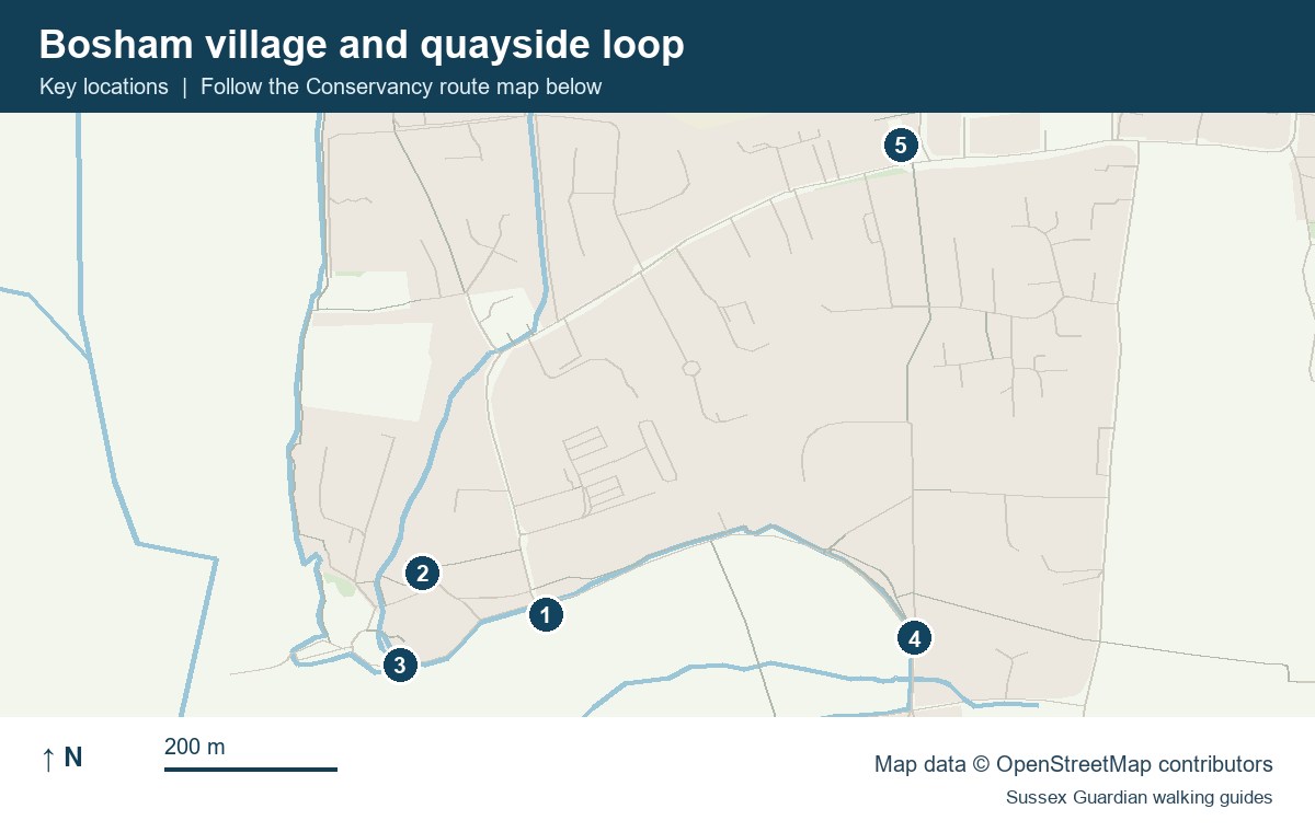
- Bosham Lane car park
- Holy Trinity church
- Bosham Quay
- The Drive at the head of the creek
- The Berkeley Arms and the return to the car park
Fishbourne to Bosham waypoints
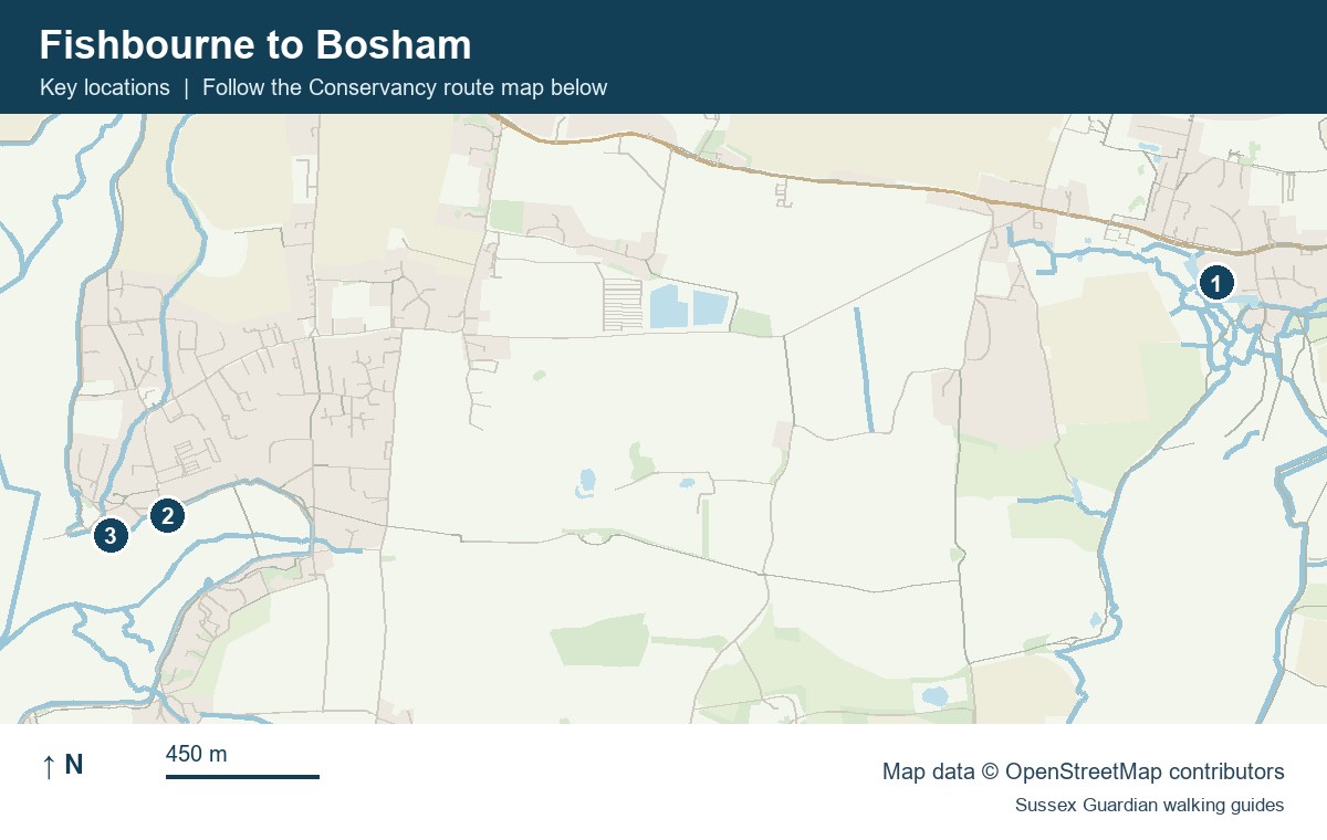
- Fishbourne Mill Pond
- Bosham village car park
- Bosham Quay
Open the Bosham easier-access map (PDF)
Chichester Harbour Conservancy route map
For more coastal and countryside routes, see our guide to walks in Sussex.
You May Also Be Interested In