













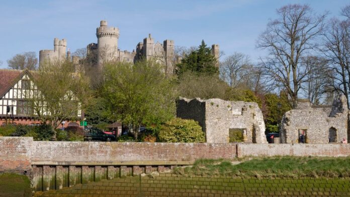
Arundel Castle comes into view early on this walk, above the River Arun. The loop then leaves the town for Swanbourne Lake and the higher ground of Arundel Park before returning through the High Street. Friends of the South Downs estimates about four miles and two and a half hours for its station loop.
Distance and walking time
| Option | Distance | Walking time |
|---|---|---|
| Arundel Bridge to Swanbourne Lake and back | About 1.25 miles / 2 km return | 30–45 minutes, plus stops |
| Full circular from Arundel station | About 4 miles / 6.4 km | About 2½ hours |
Times are planning estimates. Short distances are rounded from the mapped walking line. Allow extra time for stops, conditions and your pace. Station loop map · National Park route notes.
From the railway station to Swanbourne Lake
Leave Arundel station and use the traffic lights to cross the A27. Pick up the signed footpath to the river and follow it towards town. At the bridge, cross and turn immediately into Jubilee Gardens for the full riverside loop. The shorter walk follows Mill Road directly to the lake. The riverside approach gives you time to take in the castle above the town before the landscape opens up at the lake.
Climb into Arundel Park
Follow the guide from the lake into the park and towards the Hiorne Tower landmark. This part is more demanding than the riverside section, with uphill ground and grass paths that can be slippery when wet. The return brings you back into town by the cathedral and down the High Street towards the river. If you want a gentler outing, retrace the route from Swanbourne Lake rather than tackling the park climb.
How to get there
The route begins and ends at Arundel station. Check connections with National Rail, particularly if you are coming from along the coast and need to change. If arriving by car, starting near the town centre gives you the same lake and park highlights, with the option to skip the station approach.
The walk uses public paths and town streets. If you want to visit the castle or another attraction as well, allow separate time and check opening arrangements. Use the route notes in the park rather than assuming every track leads back to the High Street.
Step-by-step directions
Full station circuit via Jubilee Gardens
- From Arundel station, turn left and cross the A27 at the lights. At the end of the pavement take the signed footpath and turn left along the Arun towards town.
- Join the road behind the White Hart and turn right over Arundel Bridge. Immediately turn right through Jubilee Gardens, passing the friary ruins. Pick up the footpath behind the boatyard and café.
- Follow the west bank of the Arun for about a mile. Take the inland path beside the stream opposite the Wildfowl and Wetlands Trust land, then cross the footbridge below Mill Road.
- Come up to Mill Road, continue with care and cross to the lake entrance near Swanbourne Lodge. Follow the north side of the lake.
- Beyond the lake pass the first two left-hand paths. As the valley bends, take the next path sharply left up to a gate. Turn immediately right, cross the gallop, and keep Hiorne Tower on your right.
- Turn left on the surfaced road towards the park exit and cathedral. Descend the High Street, cross Mill Road and the bridge, and retrace the station approach.
Short walk via Mill Road
- Start at Arundel Bridge and take Mill Road by the castle.
- Continue to the lake entrance at Swanbourne Lodge. Take care on the short section without a pavement.
- Turn at the lodge and return along Mill Road to the bridge.
Parking, toilets and accessibility
Parking
Mill Road car park near the castle is privately run. Arun District Council says Blue Badge holders do not park there free. Crown Yard on River Road is a council car park with Blue Badge bays. Mill Road is convenient for the lake approach, while Crown Yard makes sense if you want to start with town facilities. Arundel car parks and charges.
Toilets
There are public toilets at Crown Yard, BN18 9DH, including a Changing Places facility. Arun District Council says it requires a fob and provides contact details to arrange one. Visit Arundel also lists toilets by Swanbourne Lodge. Arun toilet directory · Swanbourne Lake visitor information.
Access and surfaces
The four-mile loop includes grass paths, a park climb and the steep High Street descent. The shorter Mill Road option avoids the park climb, but take care near Swanbourne Lake where the National Park notes a short stretch without a pavement. For a shorter outing with fewer variables, stay in the town and riverside area.
Route map
Short route along Mill Road
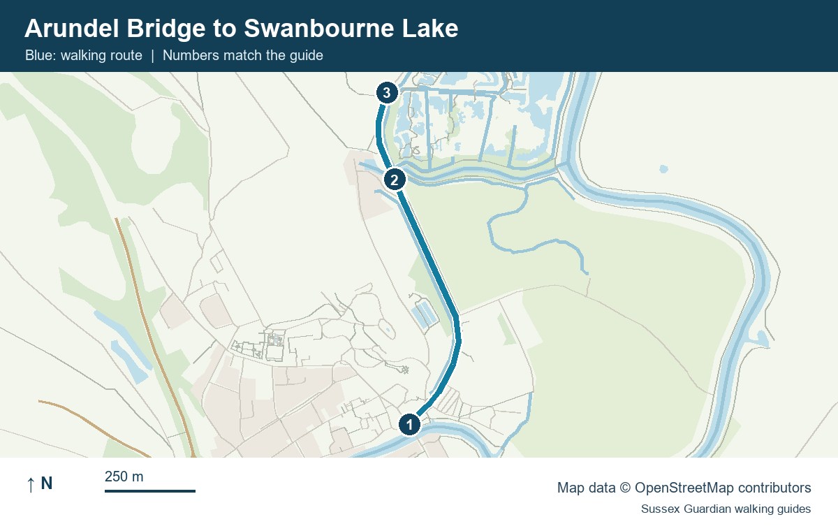
- Arundel Bridge
- Mill Road near Swanbourne Footbridge
- Swanbourne Lodge, the turnaround
Full station circuit waypoints
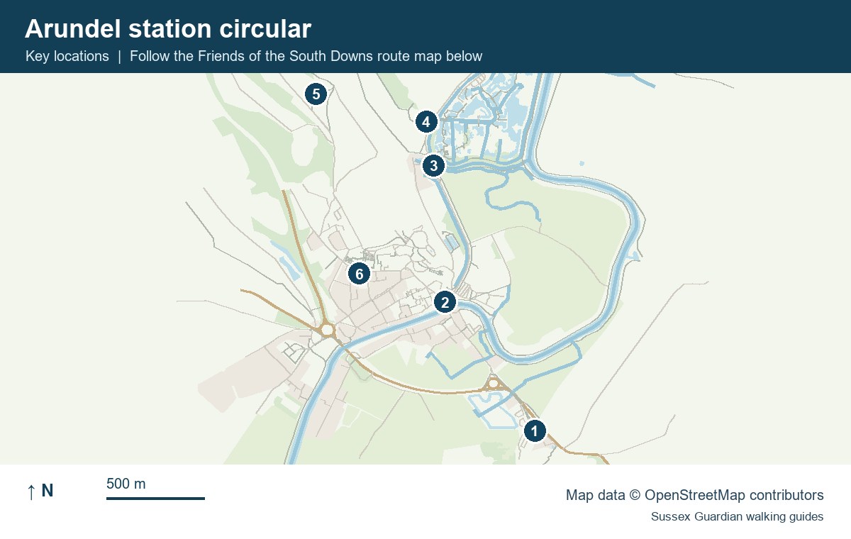
- Arundel railway station
- Arundel Bridge and the turn into Jubilee Gardens
- Swanbourne Footbridge
- Swanbourne Lake
- Hiorne Tower area
- Cathedral and High Street return
Friends of the South Downs route guide
For more coastal and countryside routes, see our guide to walks in Sussex.
You May Also Be Interested In